Technology & Innovation
Revolutionizing Indoor Radiation Safety with Advanced Nuclear Quality Radiological Survey System (ANQR™) Powered by NAC Philotechnics
ANQR is our Hardware and Software system that encapsulates th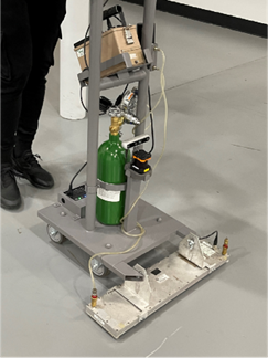 e synergistic fusion of Lidar's spatial awareness, SLAM's mapping precision, and the camera's depth perception. By combining these technologies, the Lidar-enhanced ANQR System attains a high degree of localization accuracy while navigating and scanning rooms. This multi-dimensional approach revolutionizes radiation surveys by not only identifying radiation levels but also spatially mapping these levels within a given space.
The colorful dots in the images represent the points where the laser pulses hit objects, creating a point cloud that forms a 3D representation of the space.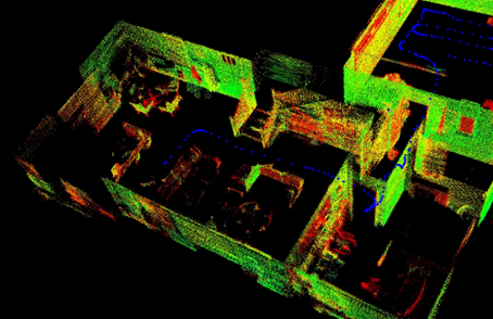
By emitting laser pulses and measuring the time it takes for them to return after hitting an object, LIDAR can create detailed 3D maps of the environment.
The blue dotted lines represent the path taken by the LIDAR system as it scans the environment in real-time. This trajectory analysis is crucial for understanding the movement and positioning of the system within the mapped space.
The 3D boundary scan creates a comprehensive map, showing not just the layout but also the boundaries and structural elements of the environment.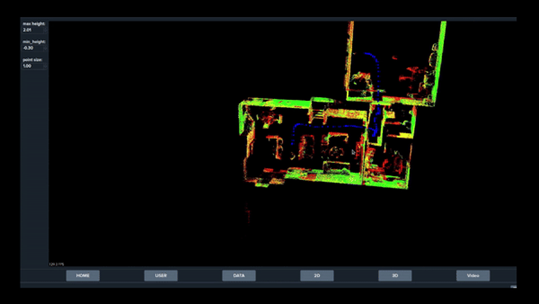
Real time 2D mapping and analysis shows the black areas that represent the detected structures and obstacles within the environment, while the white background represents the empty spaces. The green, yellow, and red dots on the path indicate different levels of radiation intensity detected at various points.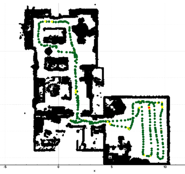
Featuring End-to-end automation by generating instant outputs
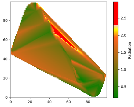 The heat graph provides an immediate visual representation of radiation levels. The color gradient from green to red helps in quickly identifying areas with higher radiation levels.
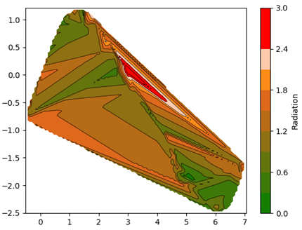
The contour map visually represents radiation intensity gradients across the surveyed areas.
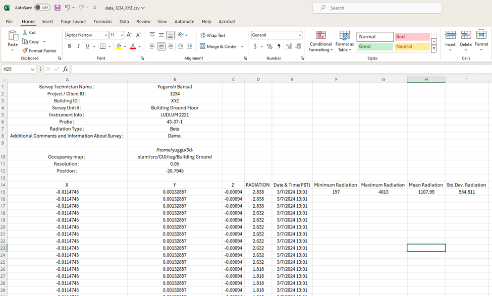
The tabulated data lists precise radiation readings along with their corresponding spatial coordinates and the date and time of each measurement, providing a comprehensive raw data report.